Remove maps-products routes
article thumbnail

Diesel is the Reason for the Sneezin’: Cleaner Holiday Deliveries are on the Horizon

Union of Concerned Scientists

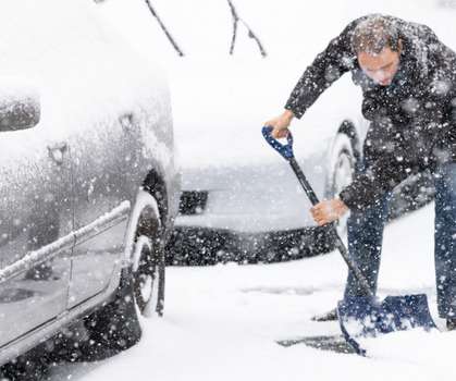
Production of the gift itself and packaging contribute to pollution, however, I wanted to better understand this “last-mile” delivery impact. How would that change if I hopped on the electric bus route at the end of my block? on routes between 250 and 450 miles.

article thumbnail

Oil Companies Plan to Take the Road Already Traveled

Union of Concerned Scientists

Yet the ensuing six months indicate companies have not altered their route despite changing conditions. Map in hand, here are some trends we can expect to see from major investor-owned oil and gas companies in the next year. That means Exxon still plans to spend the vast majority of its funds on fossil fuel exploration and production.

Insiders

Sign Up for our Newsletter

This site is protected by reCAPTCHA and the Google Privacy Policy and Terms of Service apply.

article thumbnail

Hawk Mountain Sanctuary Arts Tour Set For June 4 In Berks County

PA Environment Daily

The free driving tour takes place within a 25-mile radius of scenic Albany Township, and a printable map of the stops can be found online or the Arts Tour Facebook page. The route is numbered, but the tour is self-guided. The tour route is completely up to you; prioritize and only do as much as you can.

2022 59
article thumbnail

An encroaching desert intensifies Nigeria’s farmer-herder crisis

Circle of Blue

In the pre-colonial era, mechanisms such as the traditional administrative system which regulated grazing activities and demarcated cattle migratory routes, known as the burti, were key to establishing clear boundaries between farmers and herders. Decades ago, farmers and herders in Nigeria enjoyed a relatively peaceful coexistence.

article thumbnail

BreezoMeter’s Air Quality Data Transforms Historic Paris City Square

Breezometer

Mapping Pollution With Sensor Networks. With data also accessible to everyone via BreezoMeter’s air quality map and free app ( iOS , Android ), Parisians were able to check their local air quality regularly, just like they would the weather, and involve environmental insights and forecasts in their daily decision-making.

article thumbnail

Using Environmental Data As a Business: Where Do You Start?

Breezometer

Geological maps. f) Cleaner Route Planning & Vehicle Protection. Actively Dodging air pollution: Safe route-planning apps provide real-time visualization of environmental data with contextual insights educating users on the health risks of each option. Water & soil samples. Wildlife species & vegetation monitoring.

article thumbnail

DCNR Blog: Building The Outdoor Recreation Economy One Bike At A Time

PA Environment Daily

They also strive for advocacy and community involvement through maintaining safe bike routes and trail networks, which increases equity and inclusion throughout the area. Hope Cyclery, Cambria County Hope Cyclery hit the map in downtown Johnstown in 1976. Cedar Bicycle, Luzerne County Cedar Bicycle calls Scranton home.

2005 97