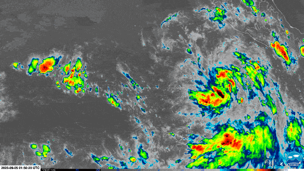
On Wednesday Tropical Storm Jova exploded into a major Category 5 hurricane in the eastern Pacific Ocean. Then, from Thursday to Friday, Hurricane Lee similarly rapidly grew in strength some 3,000 miles away, in the Atlantic.
The massive storms have come near the peak of hurricane season and during a period of unusually high ocean temperatures, which can boost the strength of hurricanes. There’s no connection, however, between these two examples of rapid intensification, which occurs when a storm’s wind speeds increase by at least 35 miles per hour within 24 hours. “Having two storms like this so close together is an interesting coincidence but not necessarily, on their own, a harbinger of what’s to come,” says Kim Wood, an atmospheric scientist at the University of Arizona.
Wood and other scientists expect that more hurricanes will undergo rapid intensification as climate change warm the oceans, providing more fuel for the convection that powers all tropical cyclones (the general term for tropical storms, hurricanes and typhoons). “A more indicative harbinger is just the number of rapid intensification periods we’ve observed in the last few years, especially in places like the Gulf of Mexico,” Wood says. They cite the particularly recent example of Hurricane Idalia, which barreled into Florida last month, and countless other storms in past few years.
On supporting science journalism
If you're enjoying this article, consider supporting our award-winning journalism by subscribing. By purchasing a subscription you are helping to ensure the future of impactful stories about the discoveries and ideas shaping our world today.
Both Jova and Lee strengthened far more quickly than the definition of rapid intensification requires: Jova’s winds sped up by about 85 mph within a day, and Lee’s did so by 80 mph within the same amount of time. Jova’s intensification rate is within the top five events in the eastern North Pacific, Wood says. And though rapid intensification has become more common in recent years, much of that has taken place in the particularly warm waters of the Gulf of Mexico and the Caribbean, whereas Hurricane Lee is still some 300 miles east of the Lesser Antilles, which mark the boundary of the Caribbean. “Lee is not the fastest [intensification] ever, but it’s pretty fast for where it was,” Wood says.
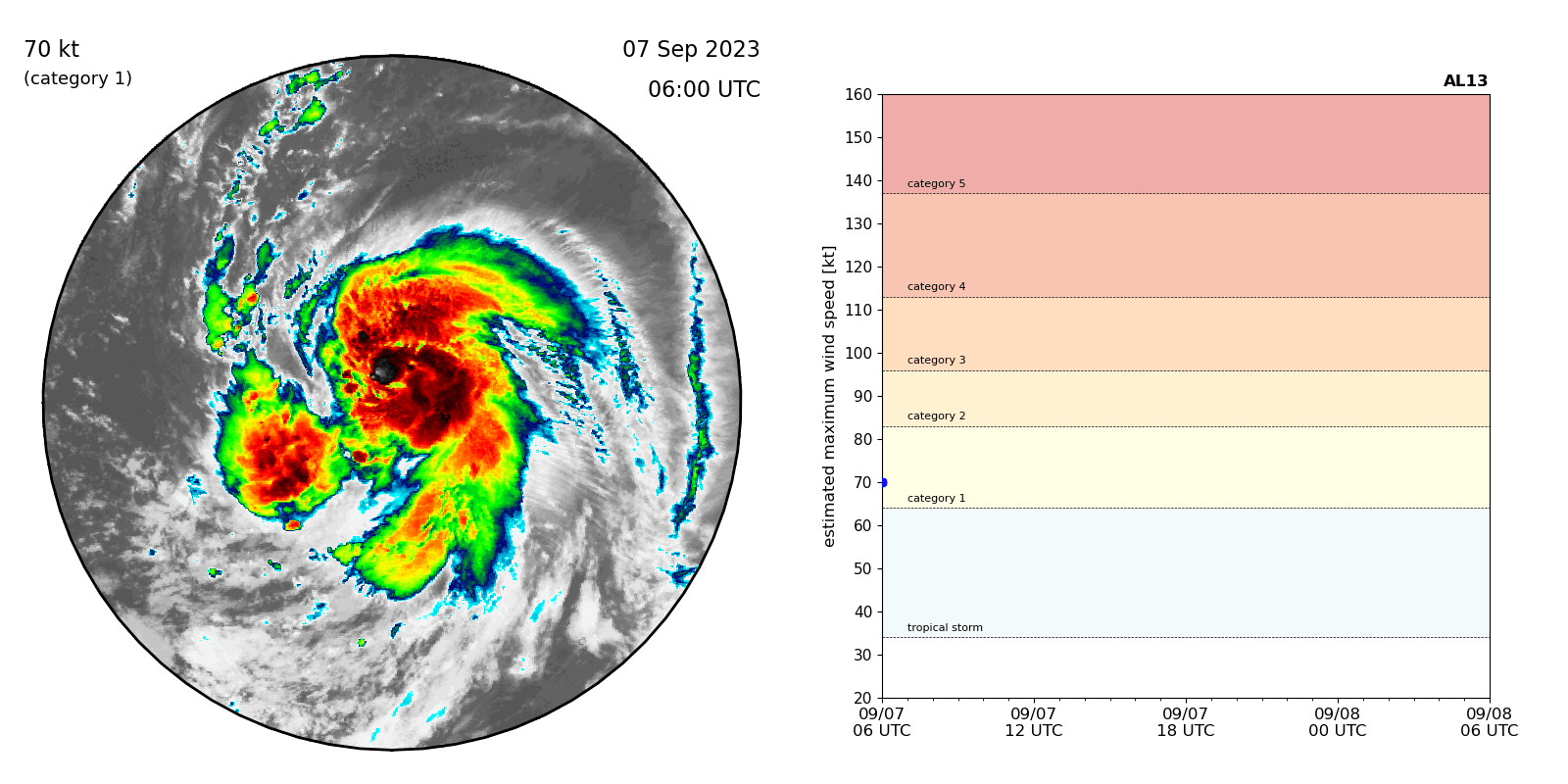
Hurricane Lee (left) underwent rapid intensification, strengthening from a Category 1 storm (yellow in the chart at right) to a Category 5 storm (red). Credit: Kim Wood, Associate Professor, the University of Arizona; Satellite data: NOAA; Intensity estimates provided by the National Hurricane Center
The coincidence of Jova’s and Lee’s near-simultaneous explosions into Category 5 storms stems in part from the rare combination of conditions that are highly conducive to storms in both the Pacific and Atlantic Oceans. The Pacific Ocean is warm in part because of this year’s El Niño climate pattern. El Niño also alters the broad circulation patterns in the atmosphere in a way that tends to quash wind shear—the crosscutting winds that can stymie storm development—in the eastern Pacific while at the same time leading to more of those winds over the Atlantic. And the Atlantic outside of the Gulf of Mexico and the Caribbean has been unusually warm unusually early in the season. “We don’t usually have such a warm Atlantic at the same time as an El Niño, and that combination supported having this phenomenon occur,” Wood says.
Ocean temperatures are only one piece of the puzzle for any powerful hurricane’s development, much less its rapid intensification. Other factors include local humidity and wind shear, as well as the storm’s internal structure. “It’s not just the environment; it’s also the nature of the storm itself,” Wood says of rapid intensification. “The environment can only do so much. It kind of sets the stage for whether this kind of intensification is possible, but then the storm also has to have internal factors that can tap into that available energy.”
Both Jova and Lee had that combination of factors and grew accordingly. Since its rapid intensification, Jova has passed over cooler waters and lost speed, dropping to a Category 2 storm. That’s not unusual in the eastern North Pacific, where environmental conditions can trigger both rapid intensification and its opposite, rapid weakening, Wood says. They also expect that Lee’s strength will change over the coming days. “Just because the storms are really strong now doesn’t mean they’re going to stay strong for their entire lifetime,” Wood says. “It will be a different type of storm than what we see right now because it will continue to evolve in response to internal changes and its environment. It being a Category 5 at one point does not mean it’s going to stay a Category 5 throughout its lifetime.”
While Jova is forecast to stay safely out to sea, Lee is approaching the Caribbean and the eastern U.S., so meteorologists will keep watching the storm particularly closely. But early forecasts of the storm’s rapid intensification are important signs that scientists are learning to understand the phenomenon, Wood says. “We knew it was going to happen,” they add. “That confidence is a testament to how far the science has come and how far our capabilities in operational forecasting have come, based on that science.”