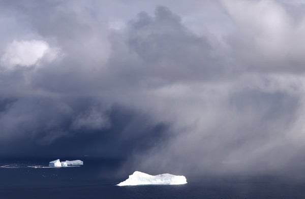
Once a raging tropical cyclone, the remnants of Hurricane Larry have transformed into a howling winter storm.
After pummeling the coast of Newfoundland last week, and then careening east across the northern Atlantic, Larry brushed past the southeastern coast of Greenland during the last few days—a rare feat for a former Atlantic hurricane.
The storm dumped blankets of snow and raised strong winds as it blew past the Arctic island. The Danish Meteorological Institute reported gusts of over 90 mph at some weather stations.
On supporting science journalism
If you're enjoying this article, consider supporting our award-winning journalism by subscribing. By purchasing a subscription you are helping to ensure the future of impactful stories about the discoveries and ideas shaping our world today.
Danish research institutes estimate that Greenland gained nearly 10 billion tons of extra snow and ice in a single day on Sunday. More snow was expected to accumulate yesterday and today.
Larry maintained hurricane status all the way to Newfoundland before converting into a post-tropical cyclone as it veered toward Greenland. Post-tropical cyclones have different characteristics than hurricanes, often developing a cold core instead of the warm center common to tropical cyclones, but they can still produce hurricane-force winds.
It’s an unusual trajectory for an Atlantic hurricane, but not unheard of. The last storm that made landfall in Newfoundland as a true hurricane was Maria in 2011, just one year after Hurricane Igor struck the island in 2010.
It’s more rare for a storm with tropical origins to strike Greenland. The last one was Hurricane Noel in 2007, which transitioned into a post-tropical system as it drifted up through New England and eastern Canada, eventually striking southwest Greenland before moving east across the Atlantic.
It’s unclear whether Atlantic hurricanes are moving farther north over time. In other parts of the world, research suggests that climate change is causing tropical cyclones to migrate toward the poles. That means coastal communities that were rarely threatened by cyclones in the past may be at greater risk in the future.
In the Atlantic Ocean, the data is less clear. Still, experts caution that warming ocean waters help hurricanes grow more intense—and they may increase the odds that the rare northern storm stays stronger for longer (Climatewire, Aug. 23).
Larry’s unusual track is the latest oddity in an eventful summer for the Greenland ice sheet.
The season began with below-average melt rates and above-average gains in snow and ice, according to the National Snow & Ice Data Center. By July, though, the tables had turned. Above-average temperatures, coupled with a low-pressure system that helped drive warm air over southern Greenland, caused two back-to-back melting events across the ice sheet in the second half of July.
Scientists estimated that 12.5 billion tons of ice melted and ran off the ice sheet in a single day, on July 28. That’s the third largest one-day melting event in recorded history, topped only by similar events in 2019 and 2012.
Another strong melting event struck the ice sheet in mid-August. There had never been such a large melting day so late in the season, according to NSIDC.
Then, on Aug. 14, scientists reported a shocking event at the National Science Foundation’s Summit Station, a research outpost perched near the highest point on the Greenland ice sheet: It was raining.
It was the first time in recorded history that rain had ever been observed at the summit, around 2 miles above sea level, where temperatures rarely rise above freezing.
After the mid-August melting event, satellite images and aerial research flights revealed deep-blue melt ponds scattered widely across the white surface of the ice sheet.
“On the transit to Kangerlussuaq, we flew over [a] set of massive melt ponds and rivers that had begun to refreeze,” tweeted NASA scientist Josh Willis, shortly after the melt event. “Our Captain Jim Haffey, who’s flown the ice sheet for 25 years, said it was more melt than he’d ever seen.”
Greenland’s biggest melt years on record were 2019 and 2012. Melt rates were highest in 2012. But the total amount of ice loss was higher in 2019, likely because snowfall was unusually low that year. Scientists estimate that the ice sheet lost about 532 billion tons of ice in 2019.
Scientists project that strong melting events will become more common on the Greenland ice sheet as the Arctic climate continues to warm. That’s a concern for coastal communities all over the world. As ice melts and runs into the ocean, it raises global sea levels.
The snowfall from Larry, while unusual, is a welcome addition to the Greenland ice sheet’s mass balance after such strong melting earlier this summer.
“Good news for the ice sheet where no significant melt or rainfall is forecasted,” tweeted Xavier Fettweis, a climate scientist at the University of Liège, as the storm approached Greenland over the weekend. “Only snow!”
Reprinted from E&E News with permission from POLITICO, LLC. Copyright 2021. E&E News provides essential news for energy and environment professionals.