
by Lisa Sheppard, Prairie Research Institute
Green energy companies seeking sites for windfarm and solar power plant development in Illinois are targeting industrially zoned settings, such as land around active and abandoned coal mines and oil fields. When considering siting decisions, companies can rely on the Illinois State Geological Survey (ISGS) to provide extensive databases and maps on the state’s geologic and mine information to save potential trouble with collapsed land.
Energy companies look for sites with preexisting industrial-scale electric hookups or, in the case of active mines, onsite electrical demands to save time and money.
“Changing zoning designations, whether urban or rural, is a time-intensive and expensive process, so already industrially zoned locations are enticing,” said Scott Elrick, ISGS geologist. “This also requires a thorough understanding of the underlying geology, including geologic hazards, potential subsurface environmental concerns, and the potential for preexisting subsurface infrastructure such as mined out areas and abandoned oil wells.”
Mine subsidence is a concern in Illinois. Before building a multi-ton infrastructure, companies want to ensure that buildings won’t crack as the land sinks. ISGS staff have received an increasing number of requests for detailed information about mines in specific locations.
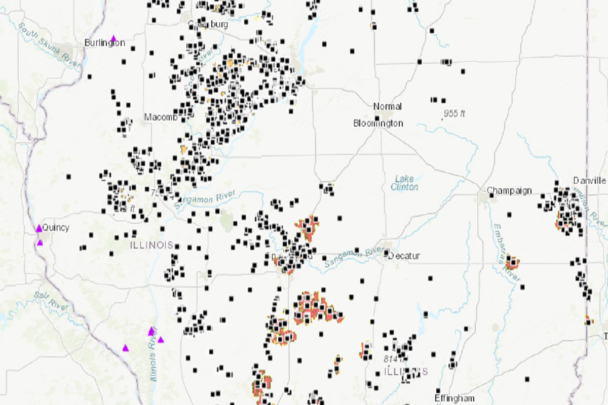
The ISGS Coal Mines in Illinois Viewer (ILMINES) is a repository of mine locations in the state. This information can give details about each mine, such as the depth and arrangement, and the type of rocks above and below the void. Downloadable GIS data and coal industry maps are also available.
“You can’t make sweeping declarations like if there is 4 feet of limestone, you’re safe,” Elrick said. “Yet the data can help guide decisions and the understanding of various factors that can contribute to mine subsidence.”
For 100 years, ISGS geologists have surveyed mines and collected information for the ILMINES database. A part of the effort has been verifying current mine maps with historical ones. There are ways to confirm recent maps, but historical maps can be questionable the further back they go, Elrick said. Sometimes, all that’s shown is the shaft entrance leading to the mine.
With mine production information, sometimes geologists can estimate how far they’ve gone underground.
“I’m proud of the fact that we’ve put in the effort to fact check and double check the maps and information,” Elrick said. “Not everyone can do that. Because of this, we have really high-quality products.”
ISGS geologists are also working on a companion mined out area wiki site co-funded by the Illinois Department of Transportation, Illinois Mine Subsidence Insurance Fund, and Illinois Department of Natural Resources – Office of Mines and Minerals. When the project is finished, the information will be a compilation of “everything that has been known about coal mines in Illinois,” Elrick said.
Another product available is the Illinois Oil and Gas Resources Interactive Map (ILOIL), a database of over 200,000 records on oil and gas wells throughout the state.
Media contacts: Scott Elrick, elrick@illinois.edu
news@prairie.illinois.edu
This story originally appeared on the Prairie Research Institute News blog. Read the original article.
