
By Tiffany Jolley, Prairie Research Institute
Across the Fox River Valley, the landscape has changed in almost unimaginable ways since the end of the most recent ice age over 12,000 years ago. Rapid expansion of agriculture, residential housing, and commercial development has replaced massive glaciers that left abundant resources of gravel, sand, and water in their wake.
Such large-scale transformations of the landscape are not isolated to the Fox River Valley, but in fact have occurred in every county in Illinois. Safe and sustainable water resources are necessary for all living things as well as for economic development within the state. In order for both to thrive, long-term groundwater sampling and monitoring by the Illinois State Geological Survey (ISGS) and the Illinois State Water Survey (ISWS) are imperative.
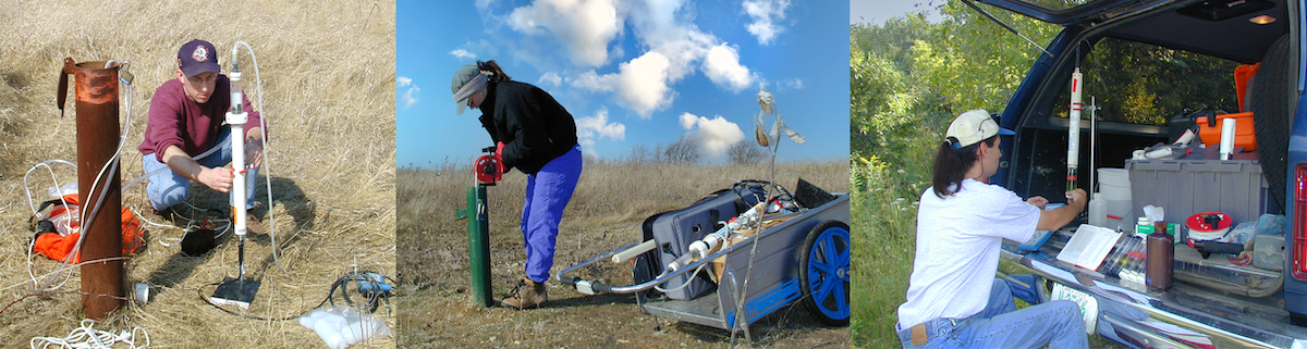
The ISGS and ISWS began monitoring the intersections between industry and the state-protected nature preserves in 1998, letting science and groundwater monitoring lead the way. Then-graduate student Randy Locke embarked on what was intended to be a two-year groundwater monitoring project; that project is now in its 24th year and has expanded to 414 dedicated nature preserves across 62,270 acres in Illinois.
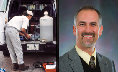
Locke is now a principal research scientist at the ISGS and knows the storied and complex histories of Lake in the Hills Fen (LITH Fen), Volo Bog, and Bluff Spring Fen (BSF) nature preserves as well as almost anyone, and has seen changes that led to land acquisitions, legal battles, and Supreme Court rulings.
“What we’re doing is unique in scope and duration. There are long-term scientific studies happening at PRI that are akin, but it is not typical that we get the chance to systematically monitor natural areas for so long,” said Locke. “These sites are legally dedicated to a statewide system forever, and there is a persistent need by the natural resources agency responsible for the site to fully inform their site management and restoration efforts.”
The ISGS Nature Preserve Program has been a long-term collaborative effort with the INPC and between scientists of the ISGS and ISWS. It takes a dedicated and talented team to conduct extensive site monitoring, maintain equipment and installations, manage the collected data, make scientific assessments, and develop reports and petitions. Approximately 20 ISGS and ISWS staff members have worked on the program since its beginning. Since 2018, Eric Plankell, associate scientist and wetlands geologist has been the program’s Co-Principal Investigator.
This model of long-term data collection has been helpful for the early detection of watershed issues, such as contamination, drought indicators, and climate change. It is also essential whenever restoration efforts are considered.
How it started
The Illinois Nature Preserves Commission (INPC) was created by the Illinois Natural Areas Preservation Act in 1963 with the mission to “assist… landowners in protecting high-quality natural areas and habitats of endangered and threatened species in perpetuity, through the voluntary dedication of such lands into the Illinois Nature Preserves System.” Dedication as a nature preserve provides strong legal protection. For example, penalties for damaging a nature preserve range from a Class A misdemeanor to $10,000 per day in civil penalties.
John Nelson is a natural areas preservation specialist for the INPC’s Area 2 in Illinois, covering McHenry, Lake, Kane, DuPage, and Cook counties. LITH Fen, BSF, and Volo Bog nature preserves are all located in Area 2.
“These are extremely rare and delicate ecosystems,” said Nelson. “You can’t find a site like Volo Bog or the fens just anywhere in Illinois.”
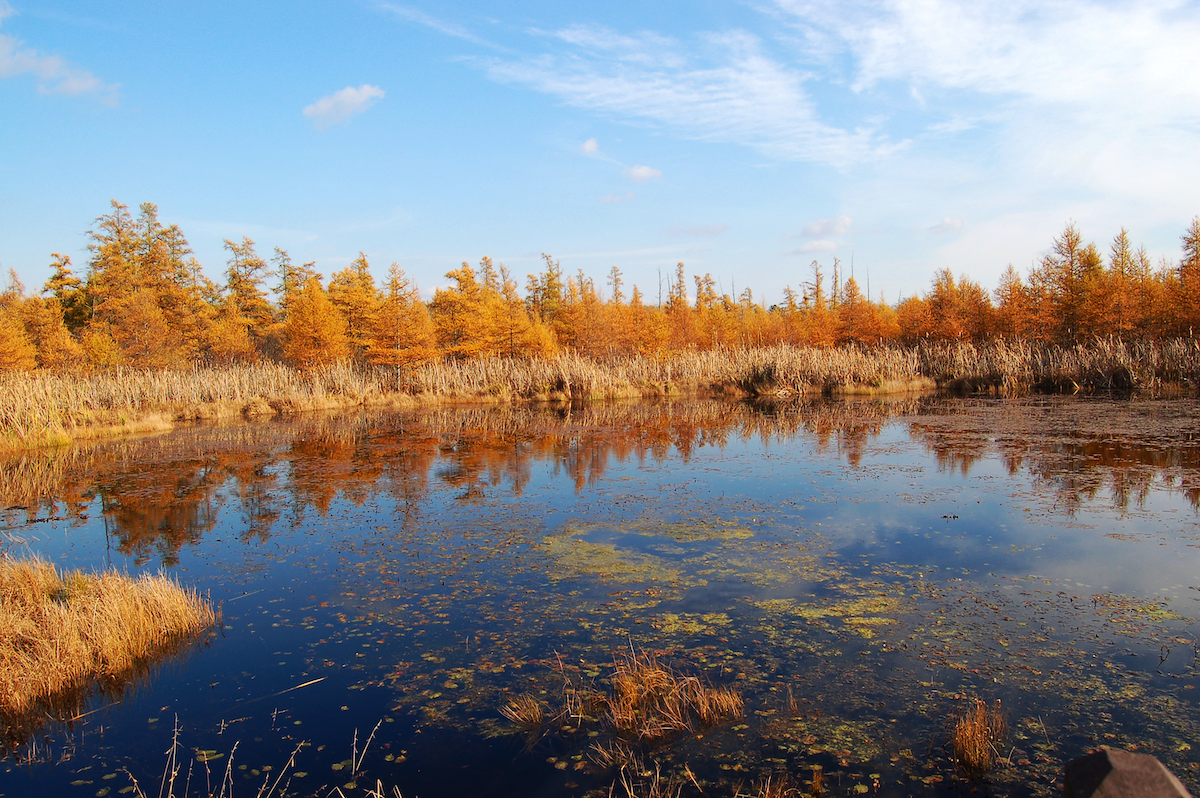
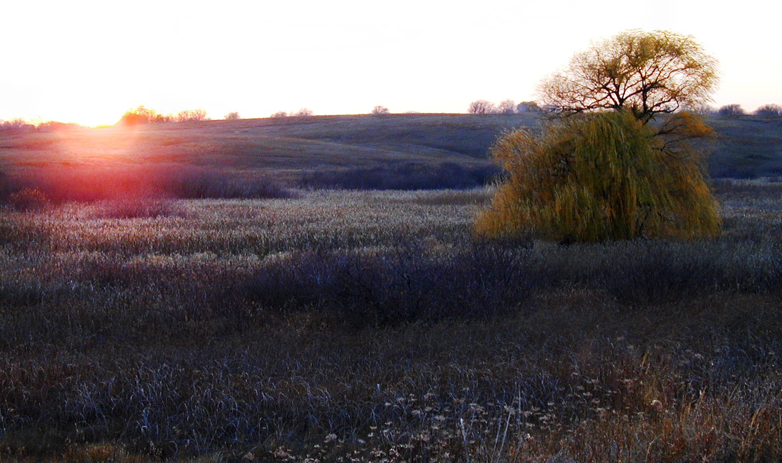
During the end of the last Ice Age, a chunk of retreating glacial ice lodged itself deep in the ground at what is now Volo Bog Nature Preserve. Several thousand years later the remnant lake began to fill with peat and vegetation, creating the wetlands present today, exhibiting all stages of bog succession. The bog was designated a National Natural Landmark in 1973 as the only remaining open-water quaking bog in Illinois.
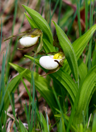
Photo credit: Chris Young / IDNR
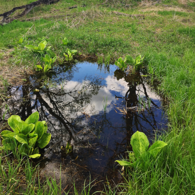
In contrast to bogs, fens derive most of their water from mineral-rich groundwater rather than precipitation. Bluff Spring Fen Nature Preserve is a rare mix of prairie, woodlands, and wetlands, fed by mineral-rich springs that support an assortment of threatened and endangered plants and animals adapted to the consistent alkaline conditions of the groundwater.
Lake in the Hills Fen Nature Preserve is home to over 400 species of native plants and wildflowers – more than 40 of which are classified as uncommon, rare, or endangered. Additionally, one can find over 60 species of birds, rare insects, and geological features called “hanging fens” left from the Wisconsin Glacial Episode. Hanging fens are formed when groundwater emerges along a hillside, resulting in a wetland on a slope. There are only 26 acres of hanging fens in the nation, and the LITH Fen Nature Preserve has approximately four of them.
Sand and gravel mining occurs adjacent to all three nature preserves and started before Locke and others began monitoring groundwater and surface water in the area. Unfortunately, the lack of historical baseline data at most nature preserves prevents the evaluation of water quality degradation from off-site activities that occurred before monitoring began. In 1996, 207 nature preserves were screened by the ISWS, and nearly half of them were categorized as having high or very high sensitivity to groundwater contamination.
“With the mining, we needed and still need lots of monitoring,” said Nelson. “The protection plans developed with the assistance of ISGS and ISWS scientists help to balance two competing land uses – protecting the groundwater and the bog and recognizing property rights and mining activities.”
Therein lies the delicate balance which science-based decision-making must strive to achieve; providing protection for sensitive ecosystems on the one hand while allowing for economic development on the other.
How it’s going
As a result of petitions submitted by the INPC, and based on input from the ISGS and ISWS, Lake in the Hills Fen, Bluff Spring Fen, Volo Bog, and 27 other nature preserves have been given Class III Special Resource Water designations by the Illinois Pollution Control Board (IPCB).
The IPCB defines a water source with a Class III designation as:
“Demonstrably unique (e.g., irreplaceable sources of groundwater) and suitable for application of a water quality standard more stringent than the otherwise applicable water quality standard and vital for a particularly sensitive ecological system.”
A Class III groundwater designation process can take years, and the ISGS and ISWS scientists work with the INPC to submit a petition to the Illinois Environmental Protection Agency (IEPA) for approval. If approved, the petition heads to the IPCB and to public review for final approval.
“It, by law, identifies the area of land that has a direct connection to groundwater supporting the preserve,” said Locke. “The Class III designation also provides vital information to share with local municipalities, based on science, to help guide development or changes in land use that could impact a preserve. Class III groundwater standards are essentially Illinois Class I (drinking water) standards, but they can be adjusted to protect ecosystems that have different chemical sensitivities. All standards proposed are reviewed by the Illinois EPA and are communicated to the public in advance through the IPCB rulemaking process.”
This designation has proven to be an effective tool to protect and guide development near nature preserves. The Class III Groundwater designation gives natural resource managers another tool to use in the review of proposed projects where negative impacts could occur on protected resources.
“We’ve been working to incorporate the Class III groundwater contribution areas into the review of proposed locations for new municipal wells, where the proposed wells will draw groundwater from an aquifer that supports a preserve,” said Valerie Njapa, the natural areas defense specialist at INPC. “Engaging with local officials has proven successful in highlighting the significance of dedicated nature preserves and endangered and threatened species, and ensuring their continued protection is part of the decision-making process.”

But adjacent land use is still a significant threat to nature preserves. Nearly anything that is put into the air or onto the ground has the potential to have an adverse effect or cause contamination, including dumping within or near a preserve, residential septic systems, roads where deicers are used, agricultural fields or feedlots, leaking impoundments or storage tanks, and certain industrial and commercial activities.
Road salt, water softeners, and fertilizers all make their way into groundwater, and once chloride dissolves into water, there’s really no economical way to remove it.
High salt concentrations in surface water and groundwater pose a significant threat to aquatic ecosystems and to infrastructure and industrial operations. Almost all of the rivers and streams monitored have had significant increases in chloride and sodium concentrations since the mid-1970s, with significantly higher concentrations found during the winter months as a result of runoff from salted roadways. Salt concentrations have increased most rapidly in the Fox River Basin west of the Chicago metropolitan area, where land use is rapidly changing from rural to urban.
Native plants across the Midwest are not adapted to increased salt concentrations, so salt-tolerant invasive species, such as phragmites, may outcompete native species.
Salt reduces oxygen levels in waterways, upsetting delicate foodwebs in wetlands by killing plants and zooplankton, while higher salt concentrations can even kill fish and wildlife directly. However, as surface water salt concentrations spike over the winter months, before rushing off into lakes, rivers, and streams into wetlands, chloride levels build over time in groundwater.
“The wetland ecosystems are some of the rarest and highest quality natural areas remaining in Illinois, and some are of global significance,” said Njapa. “The INPC has a high level of confidence in the technical expertise at the Prairie Research Institute (PRI) and can always rely on the assistance provided by the ISGS and ISWS, which is important to avert threats and prevent adverse impacts to sites in Illinois’ Nature Preserves System.”
The ISWS examined chloride contamination in groundwater aquifers in Kane County from 1965 to 2015. Almost immediately after road salt was introduced in the 1960s, chloride contamination appeared in sand and gravel aquifers. By the 1970s, road salt had permeated shallow bedrock aquifers, and by 2015 chloride levels above secondary drinking water standards (of 250 milligrams per liter) were quite common in the area.
While alternatives exist, salt is still the preferred choice for snow and ice management in Illinois. As more areas across Illinois and the country shift from rural to urban, chloride contamination will continue to be an environmental and public health issue. There are, however, “sensible salting” practices that can be more widely deployed to save communities money, while still effectively maintaining safe roadways. Those practices have the added benefit of reducing the amount of chloride that could enter groundwater and impact natural communities.
What’s ahead
One of the most pressing challenges Illinois faces in the coming decades is adapting to the effects of climate change, including impacts on agriculture and public health. Our fundamental understanding of climate change starts with accurate and cost-effective measurement and monitoring methods, which continue to advance our impact modeling and assessment capabilities. Air temperature and increased precipitation in the winter and spring followed by drought conditions over the summer have led to hydrologic extremes and impaired water conditions in the nature preserves and beyond.
“The INPC relies on long-term monitoring and data analysis performed by the ISGS to evaluate hydrologic responses to mining and other development, transportation, and climatic conditions,” said Njapa. “PRI maintains the state’s repository of geological and hydrological data, and as such is in an ideal position to assess those conditions at sites throughout the state to allow informed natural resource management decisions.”
Over time, the INPC has realized some success in minimizing impacts and improving restoration efforts at nature preserves it manages. The ISGS and ISWS have contributed to these successes by weighing in on management plans for each site, including stewardship activities and associated timelines for implementation.
“Without the ISGS and ISWS scientists, their expertise and data there’s no way we could have the good outcomes of protecting these sites,” said Nelson.
Continued monitoring of these sites and elsewhere is vital in order to inform effective solutions and policymaking at the local and statewide levels. This critical data will identify, evaluate, and document groundwater impacts on ecological environments resulting from land-use changes such as additional mine reclamation, and residential or commercial development.
For the foreseeable future, successful economies and healthy ecosystems will continue to rely heavily on data provided by ISGS and ISWS scientists.
This story first appeared on the Prairie Research Institute News Blog. Read the original story.
